Google Maps’ Street View has long been a handy tool for road riders who just want to double check that the roads they’re planning on cycling are, in fact, actual tarmaced roads. Broken surfaces, dirt and dust are all well and good on the best gravel bikes – less fun when you’d rather not put your best road bike through the wringer.
But when it comes to pure off-road riding, the insights of Google Maps are rather more limited. This is rather unfortunate, as the much more varied mix of terrain you get away from the roads makes an awareness of what surfaces you’ve planned your route over even more important than it is for pure road riding.
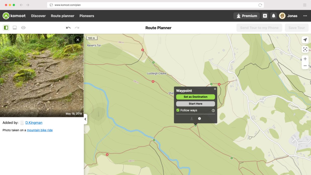
Komoot – one of the best apps for cycling – has identified this issue and developed a new Trail View format on its route planner to give users a better idea of what terrain they will be covering.
The aim of the new AI-powered technology is to help riders make informed decisions as to whether a trail is suitable for their experience level and the bike they’re using. It’s not the same continuous, draggable, 360 degree view of the trail that Google Maps offers in areas it has street-viewed – a closer analogy is that of Google Maps’ spotlight blue dots that are standalone pictures of particular spots.
Except on Komoot’s route planner, these dots will be green and you won’t be able to pan.
“Clear information about the condition and composition of the trail will help… gravel cyclists to avoid paths with rocks – increasing the likelihood of Type 1 fun all-round,” komoot sums up.
Trail View is available for all Komoot users via Komoot’s web platform, and can be used by selecting the Trail View map layer when planning a route here.
(Image credit: Komoot)
All of these images have been taken and uploaded by other komoot users who have been on that trail already.
Komoot points out that not every image taken by users will be displayed. “Trail View scans all uploaded images and shows only those with paths and trails and it eliminates images that do not fit the criteria (ie. images that include faces, animals, landscapes, buildings etc.),” komoot explains.
Over 15 Million images uploaded by komoot users and these have already been automatically scanned to identify around one million that show trails and paths.

